Ostrov Hvar - přírodní ráj
Hvar (68 km long), after Cres the longest Adriatic island, is also the fourth
largest in area (300 sq. m). The longitudinal road which links the town of Hvar
with Sućurje at the eastern end of the island is 84 km long. The high plateau
between St. Nicholas hill (626 m) and Hum (603 m) which extends from Sv.
Nedjelja to Jelsa and is partly under pine woods and partly under arable land is
marked by distinctive beauty and a fresh climate. The flat part of the island
between Stari Grad, Vrboska and Jelsa is under vineyards which produce up to
50,000 hectoliters of wine per year.

Hvar (68 km long), after Cres the longest Adriatic island, is also the fourth largest in area (300 sq. m). The longitudinal road which links the town of Hvar with Sućurje at the eastern end of the island is 84 km long. The high plateau between St. Nicholas hill (626 m) and Hum (603 m) which extends from Sv. Nedjelja to Jelsa and is partly under pine woods and partly under arable land is marked by distinctive beauty and a fresh climate. The flat part of the island between Stari Grad, Vrboska and Jelsa is under vineyards which produce up to 50,000 hectoliters of wine per year.
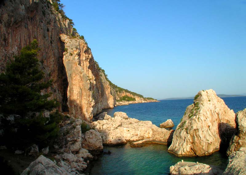
The mountain chain running along the middle of the island divides it into north and south, with outstanding peaks such as: Cernica, Hum, Gvozd and Sveti Nikola (626m). The Samotorac valley around the spring of the Pitavski potok (a stream) and the Vratnik canyon are interesting beauty spots which have become accessible by the cutting of a tunnel near Zavala. The flooded valley of the Bay of Stan Grad and Ravnice extends from the ridge peninsula on the northern side of the western part (Kabal, 125m) and the main mountain-range. The layers of sand and loess are now under the sea.
The outer shapes of Hvar are formed by its geological structure: the island is an anticline bent towards the south, composed of Mesozoic limestone and dolomite, and it is discontinuous in its relief towards Pakleni otoci and Šćedro. Geological reconstruction shows that the sea level during the last glacial period (Wurm) was 96.4 m lower than it is nowadays, which means that Hvar was originally a mountain on the mainland (722m). Storms and dry, cold winds blew loess from what today is Hvar Channel unto Stan Grad Plain, which is today undergoing a swift process of erosion. On the edge of this plain, are the three main island bays and villages. This is the most fertile of all Adriatic plains.
Hvar is less well known for its stone than the neighbouring is lands of Brač and Korčula, or Trogir on the mainland. However, the so-called "Greek Cave" near Mikićevica where one can see traces of an ancient quarry, some well-known stone artefacts, the writings of travel writers who saw Hvar as "a town of marble", and a series of well-known names of stonemasons (not to mention some of the best Croatian modern sculptors) -all point to an almost forgotten tradition of the production of stone. There are records indicating that white limestone was exported to Berlin for the parliament building, government buildings and the palaces of the federal council.
The island is covered by Holm oak {Orno-Quercetum ilicis), Aleppo pines (Pinus halapensis Mill.) and black pines (Pinus nigra dalmatica). The islet of Šćedro is especially rich in various Mediterranean trees and plants. The deciduous oriental hornbeam (Carpinetum orientalis croaticum) appears on higher hills (around 400m). The island was practically bare for centuries due to the use of pine for torches while fishing. (4 cubic metres of pine tree per one light were used in every fishing expedition).
Wine, lavender and honey have long been the main peasants' produce in Hvar. Wine from Hvar and other Dalmatian areas were successfully exported to France and then Hungary from 1870 until 1894, when phylloxera devastated the majority of Dalmatian vine yards. Then, in the first decades of the 20th century large numbers of islanders emigrated to North and South America. People from Hvar became the pioneers of wine growing in California and still participate a great deal in the production of wine there.
In the 1880s the total production of rosemary oil on the island amounted to 20,000 kg. At the beginning of the 20th century, it was exported to Trieste and then bought by perfume factories in England, France, and Germany. The rosemary is gathered on sunny days, usually from June to the middle of August, or sometimes even the end of September. It is gathered from each area on a three-year rotational basis. Only the dry leaf is distilled, not the whole plant as in Spain.
The waters around Hvar, especially in the area from Pakleni otoci to Lukavac and eastwards from Šćedro towards Pelješac, have been known from oldest times for their rich concentration of pilchard and other oily fish. From the point of view of natural science and zoology Hvar is one of the best studied islands in the Adriatic. The most important researcher was Grgur Bučić (1829-1911) who was in touch with the best European natural scientists of his time. Many examples of marine life were discovered and studied by him. He studied worms, insects Orthoptera, and was a pioneer in the artificial insemination of sponges.
In 1991 the Island of Hvar signed the Declaration of the Central Dalmatian Islands - an Eco-clean Zone.
ZDROJ: www.hvar.hr
Sdílet článek na sociálních sítích